Ralph Bagnold
Ralph Bagnold explored the Western, or Libyan desert in the late 1920s and early ’30s before founding the Long Range Desert Group in 1940.
His film of exploring the desert in 1930 and 1932 is online at the BFI and his book Libyan Sands, 1935, was republished by Eland in 2010.

Cairo 1930, 1min 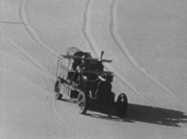
Great Sand Sea, 4min50 
Great Sand Sea, 9min 
Yabsa Pass 1932, 17min30 
Between Kharga and Uweinat, 19min30 
Arrival at Kissu, 19min50 
Penderel arrives, 22min
| Film (49 minutes) | Book (page number) |
| 00:00 First Reconnaissance of the Great Sand Sea. November 1929. (Dunes found to be passible for cars). Members of Party:- Bagnold, Craig, Holland, Prendergast, Burridge, Fernie. | 98 Expedition of 1929 |
| 00:20 Map [no footage] | |
| 00:35 Expedition to the “Great Sand Sea”. “Uweinat”. October-November 1930. Members of Party:- Bagnold, Craig, Holland, Prendergast, Newbold, Shaw. | 116 Expedition of 1930 |
| 00:50 Map | |
| 01:00 The start from Cairo. The first stick in soft sand. [footage begins] | |
| 03:25 Ain Dalla, 300 miles south-west of Cairo. Petrol supplies arrive for the onward journey into the unknown dunes. Nothing more available for eleven hundred miles. | 124 At Dalla 21-23 October 1930 |
| 4:15 Map | |
| 4:30 The Edge of the Dunes. The country becomes choked with Sand Drifts. | |
| 5:15 Dunes of the Great Sand Sea, under which 100,000 square miles of the country lie buried. | |
| 8:10 Unsuccessful experiments in Navigation. Planting a sighting-balloon to take back-bearings, for plotting the course among the bewildering dunes. | |
| 10:10 “An Island”. A Lone Rock strewn with bird skeletons. The first solid ground seen for several days. | |
| 11:10 North of the Gilf Kebir. Normal Desert, after 700 miles of sand dunes. Signs of former human occupation, 200 miles from any known vegetation or water. A circle of upright stones. | |
| 11:40 The 6,000 ft. Massif of Uweinat, from 20 miles away | 129 |
| 12:00 Jebel Kissu | 130 ‘Across the open plain… another mountain, a solitary granite peak called Kissu, rises sheer out of the flat desert to a height of five thousand feet.’ |
| 12:45 Uweinat. The water hole at Karkur Murr, at the foot of the mountain. | 130 |
| 13:30 Uweinat. Old Herri’s slave, sent down to reconnoitre us. | 135 ‘a man walked quietly out of the gorge towards us, clad in the ragged blue garment of the Guraan.’ |
| 13:50 MAP – retn Cairo | |
| 14:05 Expedition beyond Uweinat. October and November 1932. Members of Party:- Bagnold, Craig, Prendergast, Shaw, Harding-Newman, Boustead, Paterson, | 164 Expedition of 1932 |
| 14:20 MAP | |
| 14:30 The First Halt. On the Nile Valley Road, South of Cairo. | |
| 15:05 Desert edge south of the Fayum. A visit from 216 squadron R.A.F. One of squadron Leader. Penderel’s Victoria Troop carriers. | 165,166 |
| 15:55 Over looking Kharga Depression, near top of Yabsa Pass. | |
| 16:40 800 ft. descent of Yabsa Pass into Kharga Depression. The old route down the cliff, used by the Arba’in Road slave Caravans. Rediscovered by us in 1930, as a motor road into the Oasis of Kharga. | |
| 18:30 Country on the 450 mile stretch between Kharga and Uweinat. | |
| 19:35 Arrival at Kissu. Stores dumped before departure of empty cars for Selima Oasis, to fetch petrol. | 168 5th October 1932 |
| 20:00 Journey to Selima. Across 300 miles of desert, practically without land marks; and return to Kissu Dump. | 171 |
| 20:10 Map | |
| 21:05 Map | |
| 21:45 Penderel arrives in first R.A.F. machine to reach Uweinat and Kissu. Repacking at Kissu Dump. An aerial visit from Italians camped at Uweinat. Departure of Penderel. | 173 |
| 23:30 A 900 mile journey Westward, into the Sarra Triangle, another sand dune country. | |
| 23:35 Map | |
| 24:10 The Evening Work. | |
| 27:00 The Day’s Work. | |
| 28:30 Return to Kissu Dump before the 1000 mile journey south to El Fasher. | 184 |
| 29:20 Map | |
| 29:40 Yerguehda Hill. 70 miles south of Kissu. Shady cliff, painted with ancient rock pictures. Semicircle of round platforms on the plain below. | |
| 30:20 300 miles further south, life begins on the sand. A Desert Fox, A Baby Oryx Antelope, A Herd of Oryx, Ostrich, Ostrich chicks. | 188 |
| 32:25 The Wadi Howa. | |
| 34:10 Shaw Looking for Archᴂological Remains. | |
| 34:35 Further South still. Country of annual rains, but no permanent wells. Gom Gom villagers who get their water by donkey from sources twenty miles further south. | |
| 36:20 Map | |
| 36:30 The Homeward Journey from El Fasher. Intertor [Interior] of Malha crater, below desert level. Meidob tribesmen with their cattle. | 190 Arrived El Fasher 3rd November 1932 |
| 39:30 Malha Crater. A flock of sheep, pouring down the lava cliff. | 194 Crater of Malha |
| 40:10 Back into the Desert. | |
| 41:30 The Salt lake at Merga. 400 miles further homeward. | 199 |
| 43:15 Another 400 miles on. Selima Oasis. | |
| 45:00 Back to the Nile, after a journey of 5000 miles. Wadi Halfa and the temple of Abu Simbel. | 203 Wadi Halfa 19th November 1932 |
| 45:55 Map | |
| 46:00 Desert between Halfa and Dakhla. | |
| 46:54 Ascent of the great escarpment North of Dakhla and Kharga. Dakhla Pass. | |
| 48:50 Baharia Oasis. | 204 |
| 49:10 The End. |

1929 to the Great Sand Sea 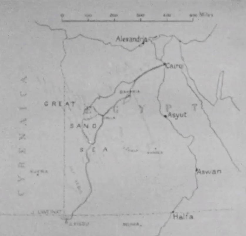
1930 to Uweinat 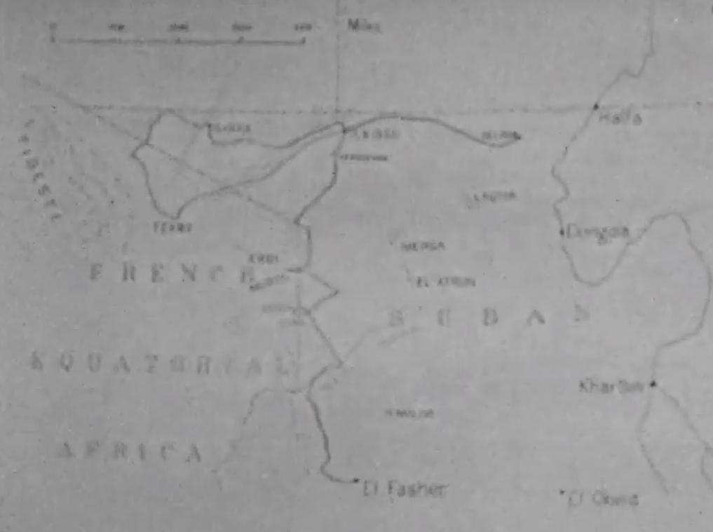
1932 to El Fasher
